Orogenic-style gold mineralization
Access is by helicopter, fixed-wing aircraft
Independence Gold has discovered a 1.5 km long gold-arsenic soil anomaly, with gold in soil values up to 1.25 g/t.The anomaly is open in both directions along strike and is situated along a ridge top which drains into multiple placer producing creeks.Trench samples across the soil anomaly have yield up to 5.14 g/t gold over 2m as well as select samples of 1.42 g/t gold and 1.64 g/t gold.In addition to the gold the company also identified an antimony anomaly of 54,500 g/t over 10 m and a select sample witih 11.2 g/t silver.The region is known to host gold mineralization associated with quartz veins as well as high-grade polymetallic veins.
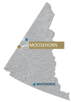
The Moosehorn project covers an area of ground in the Moosehorn Mountain Range located in the White Gold District of the Yukon.The Moosehorn Range has been explored since the 1970’s, when high grade quartz gold veins were first discovered west of the company’s current Moosehorn project.By 1975, portions of the Moosehorn range has already been sampled, trenched, drilled and had preliminary geophysics conducted.In the 1980’s, a series of placer claims were staked in the area and 13,000 oz of gold was extracted from the creeks.In the 1990’s a small hard rock operation extracted 3,225 oz of gold before shutting down in 1996.
Recent work on the Moosehorn project began in 2010 with a geochemical survey and prospecting program.Since this time, the company has continued to advance the project conducting multiple geochemical survey each expanding the known the gold-arsenic anomaly further along strike to it’s current length of 1.5 km.The company has also conducted trenching, geoprobe sampling and surface prospecting.Trenching confirmed gold mineralization related to soil anomalies and returned 5.14 g/t gold over 2.0 m in trench 1, and 0.73 g/t gold over 6.0 m and 0.52 g/t gold over 6.0 m in trench 2. Detailed quartz vein sampling within the anomalous zones of trench 2 returned values ranging from 100 to 1,600 ppb Au.
The country rock in the Moosehorn Range is composed of biotite-quartz ± feldspar ± muscovite gneiss and schist; these rocks were intruded by a Cretaceous pluton belonging to the Whitehorse Plutonic Suite which directly underlies the Moosehorn property.The plutontic rocks form as a massive hornblende-biotite granodiorite (Joyce, 2002).This intrusion was followed by a younger intrusion (96 and 100 Ma) of numerous porphyritic dykes of diorite to granodiorite (Joyce 2002) which cut the main body of the Whitehorse Plutonic Suite. Replacement of hornblende by biotite or chlorite ± epidote is widespread in the Moosehorn area (Joyce, 2002).Current understanding suggests that these dykes belong to the upper Cretaceous Carmacks Group volcanic rocks (Gordey and Ryan, 2005).
Structural geology of the area is difficult to interpret due to lack of in-place outcrop. Topographic lineaments define a major set of NNW-trending features connected by a smaller set of northeast-trending features. Lows on a magnetic total field map are parallel to this system (Joyce, 2002).